
Science & Nature
How Do Bushfires Start and Spread? The Science of Fire Weather in Australia

The short version
A bushfire needs three things: fuel, heat and oxygen. Take away any one of them and the fire goes out. Most bushfires in Australia are started by human activity or by lightning. After that, the fire stops being about how it started and becomes about the weather and the landscape, which decide whether it stays a small blaze or turns into a major fire event. Wind feeds it oxygen and carries embers ahead of it. Low humidity dries the fuel so it catches easily. High temperature pre-heats everything in its path. When those conditions line up, forecasters use a specific term for it: fire weather.
That is the whole picture in a paragraph. This article fills in the details, because understanding how fire behaves is the same knowledge the authorities use to warn communities, and it explains the orange skies and smoke haze that most Australians have seen at some point.
The fire triangle
Every fire, from a campfire to a bushfire, runs on the same three ingredients. Firefighters call it the fire triangle, and it is the simplest way to understand what is burning and how to stop it.
Fuel is anything that can burn. In the Australian bush that means grass, leaves, bark, twigs, dead wood and the fine material on the forest floor. Australian vegetation is exceptionally good at being fuel. Many of our native plants have evolved with fire and are loaded with volatile oils, the reason eucalyptus leaves burn so readily. A forest floor covered in leaf litter and bark is a fire waiting for a spark.
Heat is the ignition source, the spark or flame hot enough to start the fuel burning. It can be a lightning strike, a spark from machinery, a fallen powerline, a campfire or a deliberately lit match. The heat does not need to be dramatic. In hot, dry conditions, even a small heat source can ignite fine, dry fuel within seconds.
Oxygen comes from the air around the fire. Fire needs oxygen to keep burning, which is why wind matters so much. More oxygen reaching the fire means it burns hotter and faster, and why one of the first things firefighters do is try to starve a fire of the conditions it needs.
Remove any one side of the triangle and the fire cannot sustain itself. Firefighters use water and dirt to remove heat. They create firebreaks to remove fuel. Wind is the hardest to control, which is why the worst fire days are always windy days.
How most bushfires actually start
People start most bushfires. That is the uncomfortable, well-documented reality, and it is worth stating plainly. The human causes fall into a few categories.
Accidental ignitions are common. A spark from a mower or a grinder on a hot day, a chainsaw cutting through dry grass, a vehicle exhaust touching cured grass, a campfire left smouldering, a cigarette dropped from a car window. Powerlines also cause fires when they fall or swing together in high winds and throw sparks into dry fuel below. Each of these is a small event with the wrong timing, and on a bad day that is all it takes.
Deliberate lighting is a smaller share of the total but it happens every fire season, and it is the hardest for authorities to predict. When a fire is lit on purpose in dry, windy conditions, it can become dangerous very quickly.
Lightning is the other major cause, and it is the one that starts the largest fires in remote areas. Dry lightning, which is a thunderstorm that produces little or no rain, is the most dangerous kind. The strike hits dry bushland, and because there is no rain to dampen the fuel, the fire can smoulder and spread for days before anyone notices it. By the time it is seen, it may already cover a large area and be very hard to control.
The proportions shift from year to year and region to region, and the state fire authorities publish the causes of the fires they investigate. The honest generalisation is that in settled areas, human activity dominates, while in remote parts of the country, lightning is responsible for a large share of the area burned.
Why some fires spread slowly and others explode
This is where the weather takes over, and it is the section that explains why the same kind of spark produces a different outcome on different days.
The first ingredient is wind. Wind does two things. It feeds the fire extra oxygen, making it burn hotter, and it carries burning embers ahead of the fire front. Those embers can travel more than a kilometre in front of the main fire, starting spot fires that suddenly appear well ahead of the flames. A fire driven by strong wind is not a slow-moving wall of flame. It is a fast-moving front throwing embers in every direction.
The second ingredient is humidity, or rather the lack of it. Dry air pulls moisture out of the fuel. When the fuel is already dry, the fire catches easily and burns intensely. When the humidity is high, the fuel holds moisture and is much harder to ignite. This is why fire danger is higher on hot, dry days and why a cool change can take the edge off a fire.
The third ingredient is temperature. High temperatures pre-heat the fuel in front of the fire, driving out moisture and making everything more flammable. A 40 degree day does not just feel hot to people. It literally prepares the bush to burn.
Slope is the factor that surprises people, because it is not weather at all. Fire runs faster uphill than downhill or on flat ground. As the fire climbs a slope, the flames reach up the hill and pre-heat the fuel above them, pulling the fire forward. Firefighters talk about this constantly, because a fire on a steep slope in wind can move with terrifying speed.
The type of fuel matters just as much as the weather. Grass fires move fast but burn low and pass quickly. A grass fire can race across open country at a speed people cannot outrun, which is why grass fires are so dangerous in farming areas. Forest fires burn more slowly at the front but with far more intensity, because there is more fuel stacked up, and they keep burning in the ground and in the trunks long after the main front has passed. Understanding which kind of fire is possible in your area is part of understanding your risk.
All of these ingredients feed into the fire danger rating system, the scale from low to catastrophic that appears on signs and in weather forecasts. The rating tells you how dangerous a fire would be if one started, based on the weather that day. When the rating reaches severe or above, the safest response is to leave early, because that is the point where a fire can outrun any attempt to fight it.
When forecasters talk about fire weather, they mean these conditions lining up: strong wind, low humidity and high temperature. The Bureau of Meteorology issues fire weather warnings when the combination is dangerous, and state fire authorities use the same information to declare a Total Fire Ban. A Total Fire Ban means exactly what it sounds like. Lighting a fire in the open, including a campfire or a backyard fire pit, is banned for the day because the conditions make any fire too risky. If you see a Total Fire Ban declared, that is the day to check your bushfire plan and avoid any activity that could throw a spark.
Why the sky turns orange and red
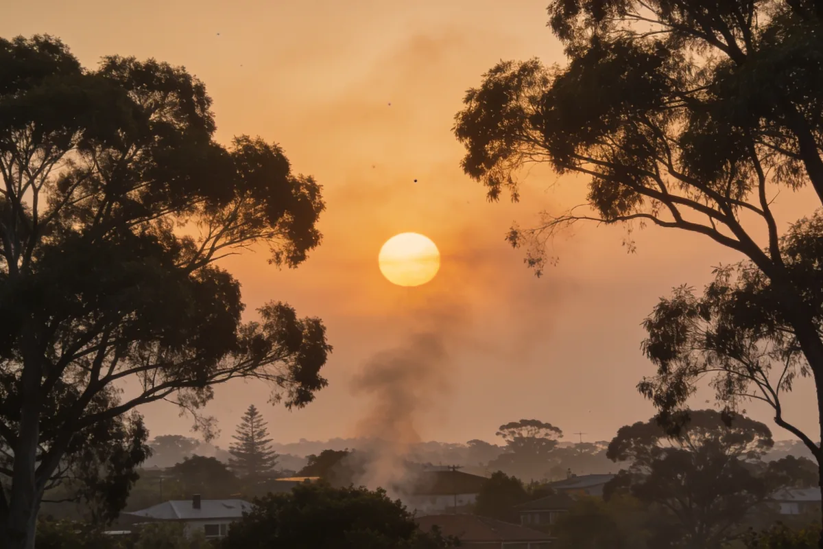
Almost every Australian remembers the first time they saw a bushfire sky. The light goes strange, the sun turns into a red disc you can look at directly, and the whole sky takes on an orange or grey-orange glow. It looks apocalyptic. The science is actually straightforward, and it is the same physics that makes sunsets red.
Light from the sun is white because it contains all the colours of the spectrum. As that light travels through the atmosphere, it collides with particles in the air, and different colours get scattered by different amounts. The tiny molecules of the air itself scatter blue light far more than red light. That is why a clear sky is blue: the blue light is being scattered in every direction and reaches your eyes from all over the sky.
Smoke changes the equation by filling the air with particles that are much larger than air molecules. Those larger particles scatter the longer wavelengths, the red and orange end of the spectrum, much more effectively. So when smoke fills the air between the sun and your eyes, the blue light is scattered away and the red and orange light comes through, which is why the sky and the sun take on that fiery colour.
A sunset is the same trick without the smoke. When the sun is low on the horizon, its light travels through far more atmosphere to reach you, and the blue light gets scattered out along the way, leaving the reds and oranges. Bushfire smoke does the same thing during the day. The thicker the smoke and the lower the sun, the stronger the effect. That is why the worst orange skies tend to happen in the morning and late afternoon, when the sun is low and the smoke is thick.
What smoke haze actually is and where it goes
Smoke haze is what remains after the fire has passed and the smoke has drifted. It is made of fine particles, most of them far smaller than a human hair, carried downwind by the same weather systems that drive the fire. Those particles can travel for hundreds of kilometres. A fire in one region can put a brown-grey haze over a city on the other side of the state, which is why people far from any flames still smell smoke and see a milky sky.
The haze looks the way it does because of the same light physics described above. The fine particles scatter the light and wash out the colours, giving everything a flat, hazy quality. The smell is the particles themselves, and it lingers because the air is full of them.
The health advice around smoke haze is straightforward and worth repeating. The fine particles in bushfire smoke can irritate the lungs, and they are harder on people with asthma, other breathing conditions, heart conditions, older adults and young children. Health departments advise people in those groups to limit time outdoors when the smoke is thick, keep windows closed, and follow their doctor’s or the health department’s advice. Smoke haze is also connected to the wider question of what is in the air we breathe, the same subject as the science of how rain and pollen affect allergies, because both come down to tiny particles travelling through the air and into our lungs.
For most healthy people, a few hazy days are an inconvenience rather than a health crisis. But the haze is a useful reminder that a bushfire’s reach is much wider than its flames. The fire may be in one valley, while its effects are felt across an entire region.
Read the sky, check the warnings
The science in this article is the same knowledge that fire authorities use every day to keep communities safe, and it has a practical job to do.
When you understand the fire triangle, you understand why a Total Fire Ban matters. When you understand fire weather, you understand why one hot, windy day is dangerous while another is not. When you understand how smoke scatters light, an orange sky stops being a mystery and becomes information about what is in the air and where it came from. Understanding the science does not make a bushfire less serious. It makes the warnings make sense, and it lets you read the sky with a calmer, more informed eye.
If a fire does threaten your area, the state fire authority is the source for current warnings. The Bureau of Meteorology provides the fire weather forecasts. Both publish clear, up-to-date information, and both are worth checking before and during any high-risk period. The same is true of the climate that shapes these conditions, which is a subject of its own, and the science behind Australia's unpredictable weather is worth reading alongside this one.
Fire season is a fact of Australian life. The science does not remove the danger, but it removes the confusion. It explains the sights in the sky, the warnings on the news and the reason some days demand more care than others. That understanding is free, it applies everywhere in the country, and it is the calmest possible way to approach a subject that can otherwise feel overwhelming.
Sources:
- CSIRO, Bushfire behaviour and management
- Bureau of Meteorology, Fire weather and warnings
- Australasian Fire and Emergency Service Authorities Council (AFAC)










The short honest answer
Yes, you can get sunburnt in winter in Australia. But the honest answer is more interesting than a plain yes or no, because it depends on where you are and what you are doing. In Hobart on an overcast July day, you almost certainly will not burn. In Cairns at midday, even in winter, you can. Out on the snowfields, you genuinely can, and the cold air will not save you.
The one number that decides it is not the temperature. It is the UV Index. Sunburn comes from ultraviolet radiation, and UV is not the same thing as heat. A cool day can still carry burning UV, and a warm one can carry almost none. That single fact is what busts the whole “it is winter, the sun must be weak” assumption.
So here is the rule that does the real work, from the Cancer Council: check the UV Index, and protect your skin when it is 3 or above. Below 3, most people do not need daily sun protection. At 3 and above, you do. Winter or summer, that number decides, not the season and not the thermometer.
One line before we go. This is general health information, not medical advice. The UV Index for your exact location on your exact day is the thing to check, rather than trusting any general article, including this one.
How sunburn actually works
Sunburn is skin damage caused by UV radiation. The sun puts out several kinds of ultraviolet light, and the two that matter for your skin are UVA and UVB. UVB is the main driver of burning. UVA penetrates deeper and is the big driver of ageing. Both do damage, and both are invisible. You cannot see UV arriving. You can only feel the result, hours later.
Here is the part that confuses almost everyone. UV is not heat. The warmth you feel from the sun comes from infrared radiation, which is a completely different part of the spectrum. That is why the two come apart so easily. A cold, windy, overcast day can carry the same UV as a warm one, because cloud cover does not reliably block UV. Thin cloud lets most of it straight through, and patchy cloud can actually push UV up, because sunlight reflects off the edges of the clouds and reaches you from more angles.
That is why “it does not feel hot” is a useless safety test, and why “there are clouds, I will be fine” is a myth rather than a rule. Your skin does not care how the air feels. It cares about UV, and UV does not send a temperature warning ahead of itself.
The other thing worth knowing is that sunburn takes hours to appear. You can burn at lunchtime and not see the redness until dinner. By then the damage is done, which is exactly why prevention beats reaction. You cannot undo a burn once it shows up. You can only treat the symptoms and wait for the skin to repair itself.
What winter UV looks like in Australia
Australia is a very big country, and its winter UV is not the same everywhere. The honest version of this article lives in the gap between the north and the south.
In the tropics and the far north, the UV Index stays at 3 or above every single day of the year, winter included. Cairns, Darwin, Broome, they do not get a winter break from UV. Sun protection in those places is a year-round habit, not a summer one. Winter is exactly when it catches newcomers out, because the cooler air makes them assume the sun has weakened. It has not.
In the southern capitals the picture is genuinely different. Melbourne, Hobart, Adelaide and Canberra all average a UV Index below 3 through the winter months. For most people on an ordinary southern winter day, daily sunscreen is not needed, because the UV simply is not high enough to cause burning in a normal amount of time outdoors. That is the reassuring half of the answer, and it is true.
This is also where the science of how Melbourne’s weather actually behaves becomes relevant. Melbourne is famous for four seasons in one day, and the UV follows the same restless pattern. The index can sit low on a grey morning, then climb by lunchtime if the clouds clear, or do the reverse. The weather changes, and the UV changes with it, which is exactly why the science of a city’s unpredictable climate and what is really going on with it matters more than a simple rule of thumb.
The upshot is that there is no single Australian answer. There is a northern answer and a southern answer, and the only way to know which applies to you on any given day is to check the number for your own postcode.
The situations where winter sunburn is real
So when does winter sunburn actually happen? The exceptions are specific, and each one tends to catch people out precisely because it feels safe.
A clear sunny day in late winter. As the weeks edge towards spring, the UV climbs even in the south. A cloudless August day in Melbourne can push the UV Index to 3 or above in the middle of the day, especially around noon. If you are outside for hours, a garden working bee, a beach day, a long lunch on a deck, you can burn.
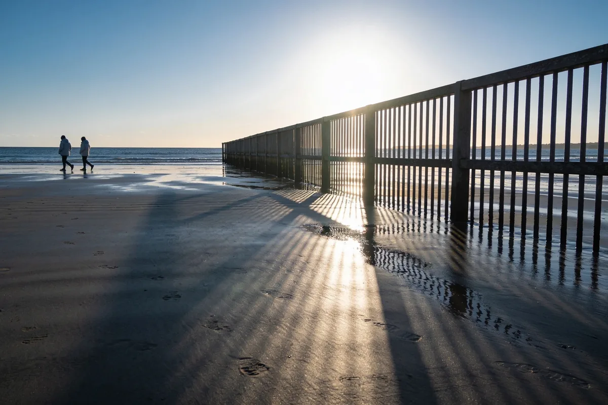
High altitude. UV gets stronger with elevation, because there is less atmosphere above you to filter it. The alpine snowfields sit well above sea level, which means the UV there is meaningfully stronger than the same latitude down at the coast. Skiing and snowboarding are prime winter burn territory for exactly this reason, and the freezing air does nothing to protect you.
Snow and water reflection. Snow reflects up to eighty percent of UV, so on a snowfield the radiation hits you from below as well as from above. Water does the same thing. That double dose is why you can burn out on the snow or on the water on a day when the UV alone would not have worried you. It is not just the sun overhead. It is the sun bouncing back off the surface under your feet.
Long days outside. Even at a moderate UV level, hours of exposure add up. A UV Index of 2 might not burn you in twenty minutes, but a full day working outside, fishing from a boat, hiking a track or watching a day of sport can still deliver enough accumulated UV to damage skin.
Very fair skin. People who burn easily in summer burn easily in winter too. If you are pale, freckled, or have a history of burning, your skin’s tolerance does not take a seasonal holiday. The UV 3 rule is a general guide, and the fairer your skin, the more carefully you should treat the days that sit near the line.
The myths that leave people burnt
Time to bust the ones that actually get people into trouble. Each of these sounds completely reasonable, and each one has a hole in it.
“Cold means safe.” Cold air does not block UV. The UV Index can sit at 3 on a crisp winter morning, and the cold only hides the damage until the redness shows up later.
“Cloudy means safe.” Cloud cover is unreliable. Thin cloud lets most UV through, and broken cloud can reflect and increase it. Overcast is not a sunscreen.
“I tan, so I cannot burn.” A tan is a sign of UV damage, not a shield against it. People with olive or darker skin burn less easily than very fair skin, but they still damage, and they can still burn with enough exposure.
“Sunscreen is only for summer.” Sunscreen is for whenever the UV Index is 3 or above, which in northern Australia is every day of the year. The season is not the trigger. The number is.
“I am inside all week, so it does not matter.” A working week indoors does not erase a weekend of high-UV hours outside. Your skin accumulates UV damage over a lifetime, not a single week, and every unprotected high-UV session adds to the total.
Spot the pattern behind all five myths and you have the whole lesson. Each one substitutes a feeling, cold, cloud, a tan, a season, a routine, for the actual measure. And the actual measure, the UV Index, does not care about any of those feelings.
Check the number, not the thermometer
Here is the habit that replaces every myth on the list. Before you spend serious time outdoors in winter, check the UV Index for your location. The Bureau of Meteorology publishes it as part of its daily forecasts, and the SunSmart app gives you the sun protection times for your suburb, telling you the window each day when the UV is at 3 or above.
When the number is below 3, enjoy the winter sun. It is genuinely good for you, the daylight, the vitamin D, the mood lift, and most people in southern Australia do not need daily sun protection through winter. This is not an article telling you to live in fear of the sun. The sun is not the enemy. Unprotected high-UV exposure is the thing to manage.
When it is 3 or above, treat it like a summer day. Sunscreen on exposed skin, a hat, sunglasses, and shade in the middle of the day. On a long outdoor winter day, a ski trip, a fishing charter, a day walking the snowfields, apply it the way you would in January. The combination of altitude, reflection and long hours can push a moderate UV reading into genuine burning territory, and that is exactly the scenario winter sunburn stories are made of.
The goal is not to be scared of the sun. It is to know when the sun is actually doing damage, and to act on the number rather than on the weather. Cold air lies to you. Clouds lie to you. The UV Index does not, which is why it is the only sun-safety test worth trusting all year round.
Sources:
- Cancer Council Australia, Sun protection and the UV Index
- Bureau of Meteorology, UV knowledge centre
- ARPANSA, Ultraviolet radiation and the UV Index

Food Waste in Australia: Why Your Veggies Die Early and How to Stop It

How to Declutter Your Wardrobe Without Losing the Clothes You Love

School Refusal in Australia: A Calm Guide for Parents When Your Child Won’t Go

The Science Behind Melbourne’s Unpredictable Climate: What’s Really Going On?

Plastic-Free Coffee Makers: Myth or Must-Have?

Zero Waste Toothpaste: What’s Worth the Switch and What to Look For
-
 Melbourne1 year ago
The Science Behind Melbourne’s Unpredictable Climate: What’s Really Going On?
-
Eco Friendly4 years ago
Plastic-Free Coffee Makers: Myth or Must-Have?
-
Eco Friendly4 years ago
Zero Waste Toothpaste: What’s Worth the Switch and What to Look For
-
 Eco Friendly4 years ago
Plastic Free Packaging: How to Keep Your Business Plastic Free
-
 Eco Friendly4 years ago
How Aussie Businesses Can Reduce Plastic Pollution
-

 Food1 year ago
The 9 Best Foods and Drinks to Enjoy Before Bed for Restful Sleep
-
 Automotive1 year ago
Wet Weather Tyres in Australia: What to Look For and When to Replace Them
-

 Eco Friendly1 year ago
Eco-Friendly Food Wrapping: Safe Papers for Sustainable Living